Tuesday 23 December 2014

Bristol's Strategic Cycling Network

Earlier this year, Bristol consulted on its Draft Cycle Strategy [pdf]. It is a wonderfully clear-headed and succinct document, and I very much hope that it translates into meaningful action.

The strategy sets out four main aims: to make cycling simpler, safer and more attractive, and to make Bristol a better place. I would like to begin by considering the first of these stated objectives, making cycling simpler.

The key points are as follows:

1. Create a comprehensive network accessible for everyone ages 8-80.
2. Adopt a simple and intuitive approach to cycle maps and signs.
3. Ensure quality facilities are in place to support people who cycle, including cycle parking and cycle hire.
4. Cycle trips will be made convenient and direct through well designed, high quality networks.

The detail

According to Wikipedia, the phrase "the devil is in the detail" does not appear in print before ca. 1975. (I looked this up because I wasn't exactly sure what people mean when they say, the devil is in the detail.)

The original phrase is much better, I think, and is generally attributed to Gustave Flaubert (1821–1880), thus: "Le bon Dieu est dans le détail". I am pleased about this, because ensuring that Bristol's four aims manifest themselves in the detail requires clarity and diligence (qualities which are not at all associated with the prince of darkness).

If, then, bicycle trips are to be made convenient and direct, as stated, it follows that the routes which make up the cycling network must reflect this.

View larger map here
The map above shows an "indicative network of priority routes" (as promoted by Bristol Cycling Campaign). It shows in red and purple what are being called Cycling Freeways, and in green Cycling Quietways.

Cycling Freeways are defined as "direct and continuous routes on main transport corridors". Over the years, it is expected that these routes would increasingly favour cycling (mostly through segregation). By contrast, Cycling Quietways are described as pleasant, often car-free routes.

There will come a time, I trust, when all of the network would be available to everyone, regardless of ability or age (8 to 80). This I see as our destination. However, such a network will most certainly be a long time coming. The key here, of course, is sustained investment.

Now, we are often reminded that we do actually have to start somewhere, and I think it is fair to say that identifying a network of priority routes is as good a place as any to begin. Therefore I was interested to see how my proposed design compared with the one promoted by Bristol Cycling Campaign (BCyC). Before I show you the results, however, I want to make a distinction between Quietways and Greenways.

Quietways I regard as mainly being on residential streets and minor roads, and Greenways I see as mainly being alongside rivers or canals, or along disused railway lines, or through parks and other green spaces. In order for Quietway routes to be useful, they must be meaningful and direct. By contrast, Greenway routes can be meandering and / or not go anywhere particular, and still maintain a worthwhile function.

The routes identified as Quietways in the map above are mostly that; but there are a few routes which are probably better described as Greenways. Certainly I have struggled to incorporate all of them into my proposed design.


The map above shows all of the BCyC-promoted Quietway routes which I have been able to incorporate into my design. The little gaps in some of the routes (from St Werburgh's to Stoke Gifford, for example) can be explained by the fact that the missing sections are shared with Freeway routes.


The map above shows all of the BCyC-promoted routes which I have not been able to incorporate into my design (including Freeway routes). The reason these routes have not been included depends. Sometimes it is the case that I think a better alternative is available; sometimes I think the proposed route is somewhat contrived; and sometimes I have to hold my hands up and admit I can't see an easy way to assign a compass colour to the route.

(Please note that the missing sections can still be coded, only not with compass colours.)

Density and connectivity

I said above that if cycle trips are to be made convenient and direct, then the routes which make up the cycle network must reflect this.

There is ample evidence to show that the development of a comprehensive, city-wide cycle network is a necessary precondition of mass cycling. However, the BCyC-promoted network lacks density and connectivity, as the map below demonstrates.

View larger map here
The map above shows all of the routes which appear in my proposed design, but which do not appear in the BCyC-promoted design. There are a few routes on main roads (shown in dark blue), but mostly they are on minor roads and residential streets (shown in light blue).

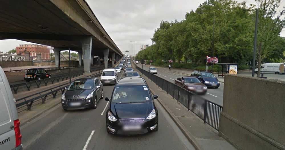
Obviously these additional routes would make many cycling trips more convenient and more direct, but they do not feature in the BCyC-promoted design. Why is this? Perhaps it is because most of the routes shown above are already functional, and are therefore not regarded as a high priority for further investment.

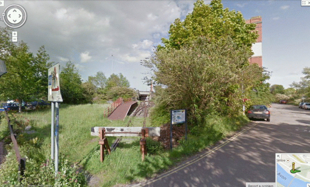
To give you just one example, this route does not feature in the BCyC-promoted design.
Image from Google StreetView

Actually I think the most likely reason that routes such as the one above are missing from the BCyC-promoted network is that the architects were limited at the outset by their choice of network design.

Since about 2003, Cambridge Cycling Campaign have been advocating an approach to network design which envisages a series of circular cycle routes—marketed as ‘Camcycle Rings’—that are intersected at regular points by radial routes that go towards the centre from the suburbs.

Camcycle Rings network

Robin Heydon, the man who designed the network pictured above, writes (source):

"Whenever I look at maps, I like to find patterns. Look at a modern map of Beijing, for example, and all you see are six ring roads. Houston, Texas, has a similar pattern—although they call them loops. When I look at the cycle map of Cambridge, I don’t see any patterns. Simply, I’m missing a strong network of easily identifiable and understandable routes that allow people to go to the places they need, without getting lost at every junction.

"Cambridge has multiple centres: a biomedical campus towards the south, the science park to the north east, the airport to the east, the university to the west, and not forgetting the city centre in the middle. [...] I have therefore concluded that we must design a network of bicycle routes that accommodates this multi-centric development pattern."

[...]

"Looking at a map of a city, you will find radial routes and orbital routes. The radial routes go in and out, while the orbital routes take you around the major congestion. Therefore we need a network of radial and orbital strategic cycle routes that link where people live to where people need to go. This is a model that works well in the car world, using ring roads, loops, beltways, orbital motorways, and the like, and therefore I believe it should also work for the bicycle."

I don't know about this. Because something works well in the car world means it's also going to work well in the bicycle world? Really? Big eyes work well well for night-time flying predators like owls. Does this mean they are also going to work well for night-time flying predators like bats? (It's horses for courses.)

Mark Ames from ibikelondon has talked about how towns and cities in the Netherlands are laid out (source). He said:

"If you look at the traffic plan for most Dutch towns and cities it looks something a little bit like [a wagon wheel]. The [hub] of the wheel represents the centre of the town. Cyclists can ride through and across and around the [wagon wheel] any way they like; private motorised traffic cannot. You can still drive a car in town—no one wants to ban cars—but to get from one side to the other, you have to leave via [one of the spokes], drive around [the wagon wheel], and go in via the side that you wish to access. This is not meant to be mean or spiteful to drivers, but it's to allow enough space in the town centre for what town centres are meant to be for: a space for people."

I do accept Robin Heydon's point about patterns, by the way. As The Oxford Companion to the Mind remarks: "All the evidence suggests that the mind is a pattern-making and pattern-using system. [...] By searching for patterns we can access information more simply and efficiently." However, the feedback from the local authority suggests it is "not certain" that "trying to make the network fit a pattern" (as opposed to trying to make a pattern fit the network) is an idea that would be taken forward (source) [pdf].

A closer look

According to Cycling: the way ahead, "studying the feasibility of a network is of a similar importance to setting up a cycling unit or appointing a cycling coordinator." It goes on to explain: "The results of a study of this kind go much further than a strictly pragmatic and ad hoc approach."

I am acutely aware that a solution which cannot be paid for is not a solution. I was curious to understand, therefore, how much more money would be needed to develop the extended network which I am proposing.

Having arrived at a design with which I was reasonably happy I then set about exploring the feasibility of this network. Now let me say first and foremost that Bristol's got some hills. So sometimes I would draw a line on the map, and then have a look at the route on StreetView, and think to myself, No, this isn't going to work very well: perhaps there's another way around this. Of course there are going to be occasions when a hill can't be avoided. The main road route tends to be the best option in this event.

So anyway, I have now completed what I call a functionality map (where I distinguish between functioning bits and non-functioning bits). If somebody with Bikeability Level 3 training is able to use the route legally, then, I suggest, the route is functional. Any improvements to this route—albeit modest ones perhaps, such as waymarking—would make it safer (than doing nothing at all).

(Making alternative cycle routes more numerous, more comfortable, easier to follow, and more convenient (by removing annoyances for cyclists, for example) is a well-established safety improvement measure. Please note, however, according to the Cycle Network and Route Planning Guide [pdf]: "Alternative routes merely supplement the main road routes, and rarely eliminate the need for cycle provision on the latter.")

The functioning bits have a total length of just over 150 km. How much would it cost to waymark these routes? If we assume a marker every 50 metres, say, this would give us 20 markers every kilometre. Multiply this by the total length, and we find that just over 3,000 markers would be needed.

Example of a route confirmation marker,
this one on the London Cycle Network
Image from Wikipedia

If we further assume that the cost of installing each marker is the rather extravagant sum of £50, the total cost of waymarking the functioning parts of an extended network would be around £150k.

Non-functioning bits

The value in waymarking the functioning bits is going to be much diminished, of course, if the non-functioning bits are left in place. (As Mikael Colville-Andersen from Copenhagenize has pointed out: "'Badly-behaved' cyclists are usually just cyclists with inadequate infrastructure" (source). Don't blame cyclists, says he, "blame your city's planners".)

How much work is needed, therefore, to get the proposed cycling network to function?

View larger map here

[Edit 18/1/15: The map above now shows *all* of the non-functioning bits of the proposed cycling network, not just those of the extended network. The photos below reflect this.] 

The non-functioning bits fall into four broad categories:

(i) Crossing points

Bristol crossing points on Make A Gif
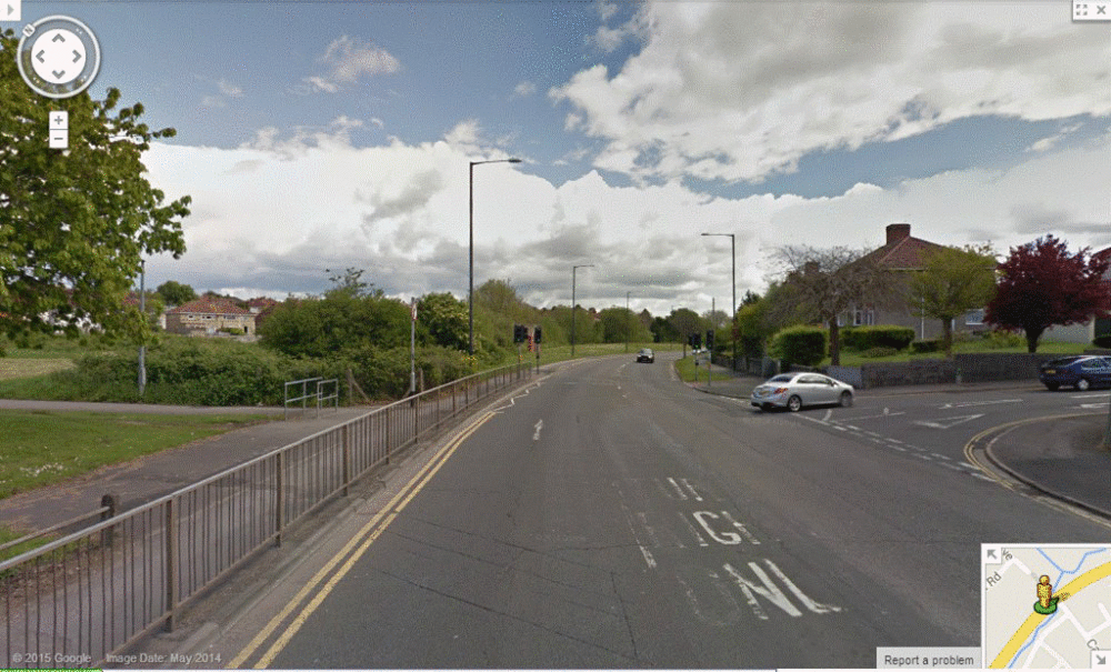
Non-functioning crossing points
Images from Google StreetView

There are twelve crossing points which I have identified as non-functioning. In one case, maybe all that is needed is a gap installed in the central reservation. In most cases, it looks as though the crossing point can be shared with pedestrians (this arrangement would therefore need to be formalised). There are a few instances where something a little bit more innovative might be appropriate.

(ii) Missing links

Bristol missing links on Make A Gif
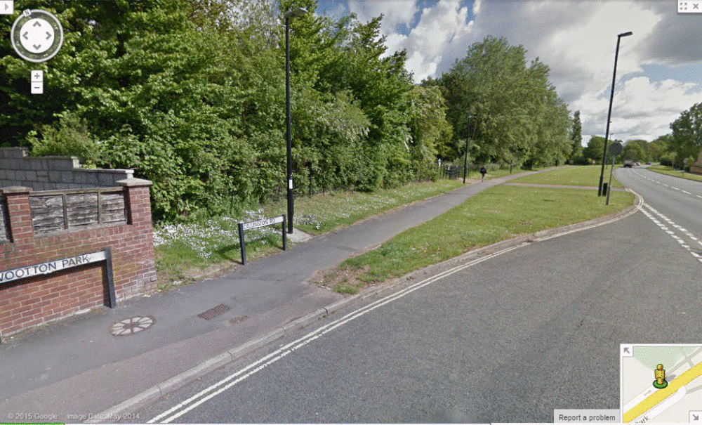
Non-functioning links
Images from Google StreetView

In all, I have identified thirteen missing or non-functioning links. Crucially, it doesn't look like a lack of space is going to be much of a problem here.

(iii) Path upgrades / steps

path upgrades / steps on Make A Gif
Path upgrades / steps
Images from Google StreetView


(iv) One-way streets

There are 25 one-way streets which are currently non-functioning and which have been incorporated into my proposed design for a strategic cycling network. Because I am limited in the number of photos that I can show in any one animation sequence, I have prepared two slideshows.

bristol one-ways on Make A Gif
One-way streets - relatively less challenging
Images from Google StreetView


Bristol one-way on Make A Gif
One-way streets - relatively more challenging
Images from Google StreetView

Conclusion

Bristol have committed themselves to the development of a cycle network which will make cycling trips more convenient and more direct. This is a laudable undertaking, but how to set about it?

Well, how many ways are there? In fact there are just two:

Adjustment policy. In the words of one blogger: "Isolated bits of infrastructure where they’re most needed (junctions, fast/busy roads), then join up the gaps, in order of neediness."

Holistic policy. In the words of another blogger: "Isolated bits and pieces don't work. The network is the infrastructure."

All of the evidence I have seen is in favour of the holistic policy. For example, Steffen Rasmussen told a GLA committee hearing: "The key word is an holistic approach, and then a separation of functions." (It was in fact the very first thing he said.)

The idea is to plan, study and introduce the network—get it up and running—and then develop it further "on the basis of priority interventions and a timetable." As before said, the key here is sustained investment.

Extract from the chapter entitled, How to start?
Cycling: the way ahead for towns and cities

So the "isolated bits of infrastructure where they’re most needed" would be installed within the framework of a functioning cycle network. This strategy has been proved to work on the continent, and ought to have been tried in this country before now.

The extended network I am proposing is intended to enhance the core network promoted by BCyC. It is clearly the case that most of the available funds would be spent on this core network. For not very much extra, however, several of Bristol's stated objectives would be met. Let's consider some of those:

"Our aim is to make cycling an easy and accessible choice for Bristol’s citizens. This means that the network must be clear and simple to understand for those getting around by bike, including mapping for journey planning and signing when travelling. The cycling network must also be direct and convenient to link citizens with key destination points such as the city centre, as well as connecting local communities."

"We will adopt a robust evidence-led approach, gathering intelligence to ensure top quality, value for money schemes are delivered."

"The proposed network is a long-term strategy to influence planning and investment decisions, and make best use of resources. The network will allow us to take advantage of opportunities, linking incremental investment into the bigger picture."

"We want innovation to be a key theme running through this strategy as we believe it is an essential ingredient to enable us to deliver our bold ambitions."


View larger map here

Bristol Cycling Campaign were kind enough to say that the above map represents "some mightily impressive and clear work". That was about eighteen months ago. Unfortunately, they felt at the time that it went "far beyond" what they were able to work with. But I hope to have shown otherwise. I hope to have shown that it would not require that much more money and effort to develop an extended network. I hope as well that people agree with me that it would be worthy of further study.


Saturday 18 October 2014

Cycle Superhighways

Typically, the aim of a strategic cycling plan is to increase the number of cycle trips whilst reducing cyclist injuries.

When Val Shawcross spoke at the Transport Select Committee hearing last December, she said:

"I think, looking back over the period of time where we've had the latest programme—since the current Mayor has been in City Hall—of trying to promote the cycling revolution—for which there is great enthusiasm in London—I mean this is seen as an enormously positive thing for our health and environment. But I think the early infrastructure was poor and was weak and did not offer the appropriate levels of protection in the most dangerous environments.

"In 2010, we carried out an early survey of the reaction of cyclists to the installation of the first two Cycling Superhighways, which I think was CS3 and CS7. We had over a thousand cyclists comment on them, and actually 60% of the people who commented said at that point they didn't feel safe enough on those Cycling Superhighways, and that was because those early Cycling Superhighways had issues on them. For example, there were areas where the strips of blue paint were too narrow, and disappeared at the most dangerous points of certain junctions; certainly there wasn't any actual physical segregation, again at the fast and most dangerous areas of the roads. And bearing in mind these are on London's most dangerous roads to begin with; I mean, by definition that's where they've gone. And we did call at that point for the Mayor to evaluate these properly and retrofit to improve them before moving on. I think since then, there's been a gradual improvement in the quality of the infrastructure that's gone in. And certainly the last extension to Cycling Superhighway 2 was completely segregated, and I think that probably represents the type of infrastructure that should have been put in in the first place. So I think there's been a long process of learning from mistakes.

As to the cost, "the blue Superhighways without the physical segregation going in were about a million pounds a kilometre, so they were already pretty expensive, and I think that's because there was a special blue paint invented for the purpose, and so forth, and so on. But there were some complementary measures as well. I think we underplay those. There were things like training schemes that went around those areas."

Cycling in Copenhagen (Picture credit: The Guardian)
The Danes invented a special blue paint for the purpose,
and then the British (of course) reinvented it.

There were two big mistakes, I think, made with the Cycle Superhighways. Firstly, they were massively over-hyped. Apart from CS3—which used to be LCN 15—the remaining three cycle highways mostly operate at a minimum level of functioning. The second mistake was that cyclists were sometimes positioned in the wrong place relative to the motor traffic, particularly at junctions, and were not therefore visible to the drivers of HGVs.

The lesson we appear to have learned from the three "blue paint" Superhighways is that only segregated facilities are appropriate on busy roads. But actually, I think this is a mistake. These high-engineered solutions are the destination, like a beacon shining brightly in the distance; if they are the start-point, it's likely to be a very long, very slow journey. (Note: CS routes 1, 4, 6, 10, 11 and 12 are currently on the "too-difficult-to-do" pile; only CS5 and CS9 are moving forward.)

When plans to build an airport in the Thames Estuary were rejected by the Airports Commission, Boris Johnson suggested that Whitehall was totally wedded to the idea of expanding Heathrow. He said: "They can't get their heads around the series of risks, as they see it, that are involved with the estuary solution. I think they take all of those risks together, and they rule it out that way. And I think that is not the way our ancestors would have approached it. I mean, we would not have a Tube system if we took this attitude."

"I remembered another wise quote: 'A man's strength is measured in tears, not his fears.'"

David Arditti said recently: "We will, for the foreseeable future, actually need to accommodate significant flows of motor traffic on many roads which the dense cycling grid (that is needed to enable mass cycling) will not be able to totally avoid."

Like it or lump it, this is how it is. The idea, then, that we should be avoiding vehicular cycling solutions (as a stop-gap) is preposterous. Done properly, they would make conditions safer for existing cyclists—not safe, necessarily, but safe-er—and could be installed relatively cheaply and relatively quickly. (For more information, please refer to this blog.)

Anyway, the reason I started thinking about the Cycle Superhighways is because of something that Mark Ames said recently. He said, "Existing cycle highways have seen increases in ridership of 30 to 40%, and that is just with blue paint." Now, I had no reason to doubt Mark, but I just wanted to check it out for myself, and have, you know, some fun with numbers.

CS3 is mostly on the back streets, so I couldn't find much in the way of up-to-date data for that. But the three other CS routes are on the main roads, and here the Department for Transport collects traffic flow data on every junction-to-junction link.

So I picked two points along each of these routes at random, and plotted that data onto graphs.


The first route I am going to look at is CS2X (indicated by the outer green placemark). This route was installed in November 2013.


CS2 (indicated by the inner green placemark) was installed in July 2011.


The CS7 route is indicated by the two blue placemarks. This route was installed in July 2010.


Online Graphing


Online Graphing


Finally, the CS8 route is indicated by the two red placemarks. This route was installed in July 2011.


As a final thought, I wanted to see what a graph showing the average use of the three CS routes would look like.


The spike in 2006 can be explained by the 7/7 bombings (July 2005).

Conclusion

If anything then, Mark understated the relative success of the "blue paint" Cycle Superhighways: perhaps as much as a 70% increase would be more accurate, though admittedly things have tailed off over the last year. By way of comparison, the only data I was able to find about CS3—a largely segregated route—showed an 83% increase (source).

Impressive though these numbers are, in the wider scheme of things, I don't think they make a hugely significant difference. There are something like 580 000 bicycle journeys made each day in Greater London (source), and between them, the three "blue paint" CS routes carry a little bit more than one per cent of the total cycle traffic.

According to a recent report on road.cc:

"The key advantage of the proposed cycleways is that they will be separated from motor traffic. As well as making it physically harder for people cycling to be hit by cars, buses and trucks, separated lanes make people feel safer, so it's far more likely they will be used."

It is true that segregated routes are more likely to be used, but actually things are not as black-and-white as the road.cc report suggests (source). The report continues:

"The poll found that only 10 per cent of Londoners say a painted cycle lane would make them feel much safer and 23 per cent say it would make them feel a little safer, versus a total of 51 per cent who say it would not make them feel safer. By contrast, 74 per cent say a physically segregated lane would make them feel safer."

A visualisation of proposed segregated cycle tracks on Bow Road (CS2)

I am specifically not saying that we shouldn't be building segregated tracks like the one pictured above. Rather, I am very emphatically saying that we should be building segregated tracks like the one pictured above within the framework provided by a functioning cycle network.

Also, what exactly is the argument or evidence which says that providing for the needs of a load of people who don't yet cycle is more pressing than providing for the needs of a load of people who do (or who are most likely to)?

I have yet to hear any such argument or evidence, though I have asked this question many times (most recently here and here). At this stage, then, I do not believe the authorities in London should be trying to develop a cycling environment around the needs of that group of cyclists known as the Interested but Concerned (i.e. the 51% of Londoners who say that painted cycle lanes would not make them feel safer). I do very firmly believe the authorities in London should be trying to develop a cycle environment around the needs of that group of cyclists known as the Enthused and Confident (i.e. the 10% of Londoners who say that painted cycle lanes would make them feel safer).

If nothing else, the benefits of this approach would be more immediate, more widespread and more far-reaching. It would cut through a lot of red tape. It would make the best use of London cycling's greatest asset: the labyrinthine network of quiet streets and parks. It won't be seriously fabulous; it definitely won't get any kudos; but it would be real.

Connectivity and density: these are not simply desirable, they are essential; and nobody, not ever, disputes this.


Wednesday 8 October 2014

Who wants to go to Acton?

It may be that some of the people who read my blog do not read all of the London-based cycling blogs, in which case, you may have missed a debate that took place on the ibikelondon blogspot (here).

The blog's author, Mark Ames, had written that the two new Superhighways "will certainly lead to a large increase in the volume of cyclists along these routes". I replied as follows:

Evidence from the States indicates things are not nearly as black-and-white as you suggest. The likelihood is that there would indeed be more cycling along the new routes, but that about three-quarters of the "new" users would already have been using their bikes for that trip.

"We're seeing people who already bike shifting the routes they're taking," study co-author Jennifer Dill said in an interview. "We're seeing a small amount of new cycling."

According to an LCC report: "Isolated cycle paths are almost useless if they’re not connected, making a network from the beginning."

The bottom line is that protected cycle lanes can't rapidly boost bike ridership without a network. David Hembrow said as much in his interview with Jack Thurston:

"Another problem with what's happened with the Go Dutch campaigning has been people celebrating [...] the idea of having a single high-quality route. This is something which the Dutch found in the 1970s had almost no influence at all on people's cycling patterns. You actually need a dense grid of high quality routes so that people can make their journeys from A to B without any problems along the way. If you have a single route, it works only if A and B are on that route. Otherwise the majority of people in the city where the new route is are completely unaffected by it."

This brings me on to another point, as expressed recently by lludovic on the LCC website:

"Who wants to go to Acton? Not me, certainly. Has any traffic survey been undertaken? What about Hyde Park to Hammersmith and then onwards to Putney and Richmond? Those boroughs have the highest proportions of cycle ownership..."

The case is, these routes are going, not where they are most needed, but where they can be installed without causing too much inconvenience. The Mayor’s press release practically says as much:

“The routes have fewer of the usual features which can make installing segregated cycle lanes difficult. They have also seen a reduction of around a quarter in motor traffic in the last ten years. Only a small fraction of the east-west route is on roads served by TfL daytime buses, for instance, and there is little residential parking along most of the routes.”

Mark's response was nothing if forthright. "I fundamentally disagree that these routes are not going where they can be useful," he said.

He continued: "I don't know who Lludovic on the LCC website is, but it does not seem sensible to base your position on the comment of just one person."


I don't yet know how far west the A40 route is planned to go, but I do know that, as things currently stand, it is not planned to go sufficiently far east.


View larger map here

During another (but related) discussion, I suggested that, in order for a route to be useful, it must be meaningful (i.e. go to the places that people want to go to), direct, pleasant (where possible) and joined up with other routes. One of the first things to be said about the Westway elevated section (shown in light blue above) is that it doesn't properly meet a single one of these criteria.


The elevated section is very nearly 2 miles, and along this length, at least five good cycle routes pass beneath it. In practical terms, what this means is that for most of the people who live in the area defined by the red border (see map below), this new cycle route is going to have extremely limited value, despite the fact that it passes directly through the middle of their neighbourhood. This is because, as far as these people would be concerned, the new route would not be accessible and / or alternative routes would be more accessible, more pleasant, more direct, etc).


Over on ibikelondon, the blog's author stated: "If it is a difference between getting it built out to Acton and not getting it built at all, I know which I would choose."

An anonymous commentator added: "There are plenty of people in Acton wanting to go to central London. Acton is a very populous area, with no good cycling routes to central London [...]. The Westway to Acton branch (which is already delayed, apparently) will have a big catchment area, with Quietways linking it to other neighbourhoods, like Shepherd's Bush and Paddington (so I was told at one of the consultation exhibitions)."

Yes, it links to other neighbourhoods, notably White City and Paddington, but look again! nowhere in between!

Paul M suggested that the superhighways proposals are "vital" for two reasons. "Firstly," said he, "I am confident that they will prove that taking a small amount of road space from motor traffic does not mean world's end and in no time at all the result will actually be an improvement on what went before, for motorists too. Secondly, I see this proposal as the canary of cycle infrastructure planning in this country. If it dies, it is telling us that the atmosphere for cycling in the UK is irretrievably toxic.

Westway on Make A Gif
The slipway road from the Westway to Paddington
In the first instance, as I said in my comment on ibikelondon, these routes are going, not where they are most needed, but where they can be installed without causing too much inconvenience. Developing routes which have "fewer of the usual features which can make installing segregated cycle lanes difficult" does not automatically mean that a worthwhile precedent has been set.

In any case, I believe that the most important thing to be proved from these Superhighways is not whether they will add to or take away from the traffic chaos, but rather, whether they will encourage more people to cycle. In this event, the real risk with the Westway link is encapsulated in this statement from Ricardo Marques Sillero of Seville (as reported by the LCC):

"Sometimes politicians want to check first if the idea works, for instance, by making one or two isolated bike paths before making a stronger decision. But isolated cycle paths are almost useless if they’re not connected, making a network from the beginning. Therefore people don’t use them and the politician becomes disappointed."

As to Paul M's second point, if this proposal dies, I don't accept that this means "the atmosphere for cycling in the UK is irretrievably toxic". The constant factors of a thoroughly-understood cycling policy are threefold: network, training / education, and publicity / promotion. If this proposal dies, I hope it means something better will come along in its place.

Better, to my mind, would be to build on the positives, and not to keep banging on about the one big negative. People don't need reminding that cycling is dangerous. But they do need reminding about some other things, however.

The fact is that these high-profile schemes are not without controversy, and that they take time to deliver. It may also be fairly added that they are not much use without good connections. These things being so, why is it that planning, studying and then introducing a comprehensive, city-wide cycle network to the point where it functions, why is that not "on the table"?

"The network you refer to already exists," Mark Ames from ibikelondon said. "We just need to be able to get cyclists in [...] London to access it."

What does this entail?

According to a European Parliament document: "Mobility encompasses not only the activity of travel, but also, more importantly, the possibility for the traveller to decide when and where to travel, by being aware of, and being able to make use of, an information set for optimising the journey."

Good waymarking and mapping is definitely part of the solution, therefore.

"Existing cycle highways have seen increases in ridership of 30 to 40%," Mark pointed out, "and that is just with blue paint."

Replicate that across an entire city, and by jingo! you'll have a cycling revolution worth its name.

"Every network has to start somewhere," Tim said.

Yes, but what is the evidence or the rationale which says that developing a couple of high-profile routes is the place to begin? Please can you quote someone.

"Cycle routes are needed EVERYWHERE," the leisurist added.

That's my point.

"I really don't think that a one third increase is such a bad outcome," Paul M suggested.

In closing, I would like to say that I applaud the ambition that is attached to these schemes. I think the section along Thames Street and The Embankment is superb. But generally speaking, these schemes fall short because they are not connected to a wider network.

Mark agrees that hundreds of smaller interventions are needed and useful. Mark agrees that it is not an "and / or" situation. Mark agrees that we need both.

However, Mark says that only one is more likely to happen than the other. I have to ask why that is, why "the table" is relatively so bare.

According to Cycling: the way ahead, the measures needed to get a network to function may be adopted automatically, "without major risk of error or loss". If the people who wrote this are telling the truth, why do we not believe them?

Tuesday 8 July 2014

Five steps, eight reasons

In the Foreword to Cycling: the way ahead for towns and cities, Ritt Bjerregaard suggests that the worst enemies of the bicycle in urban areas are not cars, but longheld prejudices. She continues:

“The handbook therefore corrects some of the prejudices connected with the use of the bicycle as a regular mode of transport in the urban environment. It also suggests some simple, inexpensive and popular measures which could be implemented immediately. Certainly the task is ambitious, but the essential thing is to take the first step, because whilst the use of the bicycle is a choice for the individual, it is essential to launch the process by which your city builds on the initiatives and habits of some of your fellow citizens.”

This process can be summed up as follows:

1. Think in terms of a network.

"Isolated cycle paths are almost useless if they're not connected, making a network from the beginning." (Ricardo Marques Sillero, Seville)

“Once there is a connected network, the attractiveness of biking goes up a lot.” (Matthias Doepke, Chicago)

"The key word is an holistic approach and then a separation of functions." (Steffen Rasmussen, Copenhagen)

2. Plan the network.

"We need an intelligent, systemic plan. This plan should connect the dots with a rational network of bike lanes. This plan cannot be developed piecemeal. Bike paths need to flow like bloodstreams: we need networks, not snippets." (Daily Times (New York), 17 September 2012)

“In planning for cycling, the critical thing is to design your network correctly: everything else is trivial." (Johan Diepens, Dutch Cycling Embassy)

"The key place to start is for everyone reading this article to take two minutes to ask themselves: ‘What does the place I want to live in look like? What kind of place do I want my kids to live in?’ I doubt anyone’s vision involves more cars or more parking. For me, I want my kids to be able to ride to school and the park, I’d like to be able to pedal to the station or shops. This can only happen if there are less cars, and people will only use cars less if they are not the easiest solution. So, the key is local governments having a clear and detailed holistic view of what they want their cities to look like in 10 years. Only then can you measure actions and ask: ‘Does this get me closer to the vision or further away?’ (Chris Boardman)

Analyse journeys — origin/destination (headcounts, statistics, interviews). (p.56, Cycling: the way ahead)

Design from patterns to details. (Permaculture Design, principle 7)

3. Study the feasibility of the network.

Only by studying a cycle route network will it be possible to truly grasp the situation. (p.40, Cycling: the way ahead)

Studying the feasibility of a network is of a similar importance to setting up a cycling unit or appointing a cycling coordinator. (p.57, Cycling: the way ahead)

4. Introduce the network.

“The network can be introduced on the basis of an overall plan (preliminary plan). Ideally, such a plan ought to be based specifically on cycle routes that have been studied [...]. If it is not possible to systematically remodel the entire network to better meet the needs of cyclists [all in one go], specific action can be taken on each occasion that works need to be done. Most of the time, the additional expenditure needed to meet the requirements of cyclists is comparatively minimal.” (p.56, Cycling: the way ahead)

"The level of minimum functioning is a prudent course to follow." (p.56, Cycling: the way ahead)

"All the installation measures which call for little planning may be applied without major risk of error or loss [...] Given their low cost, the small amount of extra work which they entail, and the possibilities of corrections in the case of error, such measures may be adopted automatically. Even if their impact is not massive, it will be real (improvement of cyclists’ comfort, raising the awareness of motorists, encouraging the mass of non-cyclists who are most likely to take up cycling again.” (p.56, Cycling: the way ahead)

5. Develop the network.

Develop the network further on the basis of priority interventions and a timetable. (p.56, Cycling: the way ahead)

* * *

In my view, even if cycle networks don't function at a very high level to begin with, there is still some considerable value in getting the network to work. 

Indeed, the main feature of a 'network first' approach is "the improvement of cyclists' safety, based on the implementation of 'soft' measures in the short-term, and 'hard' measures in the medium-term." Other points of interest are as follows: 

1. Cyclists are enabled to get from A to B efficiently, by being aware of, and being able to make use of, an information set to optimise their journey.
2. The network is established and made to work, serving the needs of the Enthused and Confident cyclist, and providing a solid foundation from which to build up.
3. Cyclists are provided with regular physical cues, thereby reducing confusion and the possibility of error (see Susan's comment).
4. Cycling is legitimised, particularly on one-way streets, or in parks, or even when riding in the primary position, thereby moderating the prejudice that many people have against cyclists.
5. "The existence of a plan increases the effectiveness of each intervention made in favour of cycling by the mutual consolidation of the various measures taken or features installed" (page 58, Cycling: the way ahead).
6. As Dave Horton, author of the hugely-influential Understanding Cycling and Walking, writes: "The more people can see the bigger picture, the more supportive they will be." 
7. It generates momentum. (The eastern philosophers talk about the hardest step being from zero to one.)
8. It enables the authorities to act in a targeted way.

In my blog on  Portland, I wrote:

"In the spring of 1994, members of the City’s Bicycle Advisory Committee and staff from the Bicycle Program hosted a series of 12 two-hour public forums which were attended by over 600 people. At each of these forums, participants discussed the good and the not-so-good features of bicycling in  Portland. The most prevalent view was that isolated cycle facilities may get all the kudos, but it was the lack of connections between these facilities that was the cause of the greatest frustration."

The point being, of course, that if there is no network plan in place, then it becomes extremely difficult to ensure that the lack of connections between facilities is properly addressed.


Sunday 19 January 2014

Route selection

I have enjoyed Mark Ames' little season of Friday TED talks. To accompany Sir Tim Berners-Lee's presentation on raw data, Mark wrote:
Once upon a time, roads might have been built speculatively, or bike lanes installed where it seemed a good idea, rather than where there was a real need. We now live in a new age of "big data", where numbers can become the foundation of more successful solutions.
And then this caught my attention from Mia Birk's presentation on riding a bike in Portland:
If we plan and build our cities around driving, then that's what we'll do. If we plan and build around bicycling and walking—and then encourage people to do so in ways that are meaningful to their lives—then that's what we'll do.
All of this put me in mind of something documented by Chris Mason from Bristol. He reported on a presentation given by Johan Diepens of the Dutch Cycling Embassy, in which it was noted that consultants had devised this somewhat convoluted way to direct cyclists around a junction, and were surprised that cyclists were not using it.

So, Johan said—employing what Chris felt was impeccable Dutch logic—develop routes which are meaningful and direct, and then there won't be any need for a complicated arrangement of signs (which most people will ignore in any case).

This led me to consider a comment made by Danny Williams from Cyclists in the City, who pointed out in one of his blogs that some of Westminster's cycle network must have been designed by a drunken spider. Indeed. But in this instance, is it in fact the case that the spider is being entirely irrational?
Surely the course of this route has largely been influenced by Motion 3. This means to say, because Westminster do not feel it is appropriate to install protected cycleways along the length of this route at this stage, and because the London Cycling Campaign do not accept the "prudence" of "introducing" a network to the point where it functions—yes, at a minimum level to begin with—not everywhere, of course, but here and there, certainly—then what we end up with is a higgledy-piggledy compromise.

This has to be regarded as a contravention of Motion 5, which says that:
Network elements must not be such as to involve a trade-off between safety and convenience; in other words, cyclists wanting the safest journey should not be forced to use a less convenient or slower route, or a route having lower priority, because the most convenient, fastest, or most prioritised route is engineered to a lower safety standard.
I have said before that identifying routes which are meaningful and direct is something that can only be done during the planning phase, and making them safe and comfortable is something that can only be done during the development phase.

This has never been refuted, but I have learned that in the world of cycling advocacy, this doesn't make as much difference to the way people think about things as might well be the case in other areas of human endeavour. Even so, it would be astonishing to imagine that anyone could seriously believe it is not necessary to prioritise between the various network elements.


Green < 1000; light blue < 1500; dark blue < 2000; yellow < 3000; orange < 4000; red > 4000
Full-size map available here

As you can see from the map above, the proposed central London bike grid (marked in black) avoids Bank junction entirely; the links between Aldgate junction and the rest of the network are incoherent and meaningless; there are some routes which are very popular with cyclists that have not been included as part of the network; and that's not everything.


Full-size map available here

Remembering Mia Birk's exhortation that we must plan and build for the bicycle in ways that are meaningful to people's lives, what meaning should we attach to a route that adds nearly half-a-mile to a crosstown journey?

* * *

It is fair to say, as the Cycle Network and Route Planning Guide points out: “Alternative routes merely supplement the main road routes, and rarely eliminate the need for cycle provision on the latter.” Even so, evidence from the Netherlands suggests that cyclists "often prefer a quiet residential street to an autonomous bicycle path alongside busy traffic arteries" (source).

Certainly I do not believe that Dutch cyclists are any different to British cyclists in this regard. Indeed, as Rachel Aldred noted during her testimony to the GLA's Investigation into Cycling, TfL advertising campaigns on cycling—which Rachel was sure had been well researched—show that what people want is to be able to cycle in pleasant conditions, away from lots of motor traffic. "And so we need to replicate those kinds of conditions where possible," she added.

Recently, Andrew Gilligan appeared on a BBC radio documentary entitled Right of Way: cycling and the city (presented by Dr Kevin Fong). Here is an excerpt:
[London hasn't] got some of the advantages that other cities have got. Unlike Paris, London was not completely rebuilt in the late nineteenth century; unlike New York, it was not built from scratch in the late nineteenth century: it's largely a pre-nineteenth century street pattern. But what we have got is this kind of matchless network of side streets, parks, routes [alongside] canals. Those are the roads I tend to use. 
My last blog included a series of maps which showed all of the back street routes and all of the routes through parks which feature in my proposed design (regardless of whether or not these routes are currently functional), together with all of the main road routes which are planned to be included as part of the central London bike grid. The total length of these various routes amounts to about 220 miles.

Not shown were those main road routes (i.e. the A roads) which feature in my proposed design but which do not feature in the central London bike grid. The total length of these routes amounts to about 34 miles.

Before I show you some maps, I just want to emphasise that the latest version of my proposed design is just that: the latest version. Things can be changed around, new routes can be added, proposed routes can take a different course, nothing is set in stone.

Another thing to say is that I am human too: I make mistakes the same as everybody else. And because no one gives me any feedback particularly, it's left up to me to scrutinise my own work.


Red: LCN routes Green: LCN+ routes Blue: CSH routes Orange: Proposed routes
Full-size map available here

The map above shows routes that feature in my proposed design, but which do not feature in the proposed central London bike grid.

The red-coloured routes depict old LCN routes. Most of these routes appear now to have been discontinued, but one lingers on in the form of CSH9.

There are a couple of very important LCN routes which have not been included in my proposed design: LCN9 from Shoreditch down to Monument, and LCN11 / LCN40 from Aldgate to Holborn Circus (via Bank). More on that another time.

Full-size map available here

The orange-coloured routes from the previous map have been reproduced in the map above. Those sections which are not currently functional are shown in red.

* * *

One of the things that struck me about the radio documentary was that Andrew Gilligan and Kevin Fong (who recently presented the Channel 4 series Extreme A&E) seemed to have very slightly different ideas as to what was most important.

This is what Andrew Gilligan said: "We have to tackle two issues which restrain cycling: there is actual safety, and there is perceived safety. They're both serious problems. I would say they're equally serious."

And this is what Kevin Fong said: "The highest priority is to avoid preventable deaths."

That I not be accused of selectively quoting Mr Gilligan, he went on to say:
I think perceptions of safety are as important an issue for us as actual safety. As I say, I think actual safety is an incredibly important issue, and we absolutely don't neglect it. But I think perceived safety is also tremendously important, and the danger to my mind is that people are being unnecessarily scared away from what is actually a health- and life-giving pursuit. We know that regular cyclists have the fitness on average of someone at least ten years younger [etc, etc], so cycling is far more likely to prolong your life than it is end it, and it is far more likely to improve your health than it is harm it, and I'm concerned that this health- and life-giving activity is being damaged unnecessarily by an unsophisticated interpretation of statistics, and also by, kind of, the understandable tendency to take dramatic but exceptional incidents as representative of the whole. 
Interestingly, Andrew Gilligan told the Transport Select Committee that perceptions are much less in TfL's control, than are, for instance, the physical state of the roads. "We can do something about the roads," he said, "but perceptions are largely in control of others, such as the media and cycle campaigners." So why not do something about the roads? H.G. Wells noted, "A newspaper is a device incapable of distinguishing between a bicycle accident and the end of civilisation." So why not do something about the roads?

I wrote in my blog, Safety: a responsibility:
Providing for the safety of cyclists is a necessary prerequisite of any policy which seeks to promote cycling as a daily mode of transport. 
A large number of potential cyclists are already thinking about cycling today, but before they get back into their saddles, they want to see some movement from the public authorities: a message, perhaps, along the lines of: "It’s safe to ride a bike, and it's going to get safer—your area authority know what needs to be done, and is now taking care of it."
That was adapted from Cycling: the way ahead, and the very clear message is that if the authorities started doing something about the roads, the perceptions would take care of themselves.

This is from the Cycle Network and Route Planning Guide:
Strategic cycling plans need to address the four Es—engineering, education, enforcement and encouragement. Typically, the aim is to increase the number of cycle trips whilst reducing cyclist injuries.
Another thing to report from the radio documentary is that Andrew Gilligan did that thing again where he takes the statistics from a single year (2002) and then compares it with the statistics from another single year (2012), and deduces from this that there has been "a dramatic improvement in the fatality rate." (Presumably this is what he would call a "sophisticated" interpretation of statistics.) Interestingly, had he used statistics from ten years ago, instead of from twelve years ago, he would have reached a starkly different conclusion.

Anyway, he was asked to explain why cycling is now "dramatically safer". He replied:
I think because there are more cyclists on the roads. I think drivers have become more habituated to them, and I genuinely do think there is Safety in Numbers.
The crazy thing is, as the map below shows, many of the roads that cyclists are currently using in large numbers have not been incorporated into the plan of the central London bike grid.


Green < 1000; light blue < 1500; dark blue < 2000; yellow < 3000; orange < 4000; red > 4000
Full-size map available here

If Andrew Gilligan is right to warn against unnecessarily scaring people away from what is actually a health- and life-giving pursuit, and if he is right about Safety in Numbers, then why are so many strategically important main roads missing from the plan of the central London bike grid?

Closing Remarks

Thinking about the most recent of Mark Ames' Friday TED talks, I wondered how Jason Roberts would set about developing a comprehensive, city-wide cycle network ...


Then I thought that this "minimum functioning" approach would never work here, what with our culture of "elf and safety" an' all. But then I remembered that a consortium of five boroughs had sought to test this strategy back in 2003 and then again in 2006, so maybe there is no reason to give up hope just yet.

The BBC radio documentary, Cycling and the City, finished very strongly, I thought. This is how the programme's presenter brought everything to a close:
There is without doubt more to gain than there is to be lost in encouraging people to cycle. And Andrew Gilligan's right about perception. But this all boils down to quality: the quality of the debate, the quality of the data, the quality of our interventions and our ability to know that they are working. The deaths on our roads are always tragic, but the avoidable deaths are simply scandalous, and we'd do well to know the difference between the two; we'd do well to know what was working and why. All of that has to improve together if we're to realise our ambitions in giving people the confidence to cycle in our cities that they deserve. 
It seems to me that if we really are to improve the quality of the debate regarding the long-term development of an amenable cycling environment, then we need to start discussing realistic ways of treating the functioning parts of the network (bearing in mind that the Dutch, for example, think about these things in twenty-year cycles).

Sheryl Sandberg (COO of Facebook) has said: "Done is better than perfect." Is she wrong?

Saturday 11 January 2014

A post full of maps

"Remember who we're doing this for," David Hembrow pronounced not so long ago, echoing the London Cycling Campaign's view that the routes on the recently-proposed central London bike grid "must be just as suitable for children, inexperienced cyclists and disabled cyclists as they are for faster commuter cyclists".

Okay, so obviously I'm being a bit dense here—obviously—but is it in fact the case that the people we're not doing this for, to quote Cycling: the way ahead, is "the mass of non-cyclists who are most likely to take up cycling again"?

"We are convinced," says the London Cycling Campaign, "it would be a mistake for the quality of any elements of the network—for example, the Superhighways or the Quietways—to be designed in a way that makes them less suitable for any type of cyclists [sic]."

A man on a Boris bike is heading the 'wrong way' down Brick Lane

Look out, Mister! There are two policemen heading towards you!

Perhaps the law-breaking eco-tosser is going to return the hire bike at
that there station?

No, along the road he continues, to the complete indifference of
absolutely everyone.

The problem with Brick Lane—as with many roads in London—is not safety, but access. To give you another example, you can see what I mean with this little animation sequence (also from Google StreetView).

Ennismore Gardens Mews
In a very long and detailed publication entitled Cycle Network and Route Planning Guide (reported here), four points stood out for me personally:
i. Typically, the aim [of a strategic cycling plan] is to increase the number of cycle trips whilst reducing cyclist injuries. 
ii. Strategic cycling plans should consider whether or not it is practical to design facilities so that they are suitable for cyclists of basic competence. 
iii. Indirect cycle routes may lead cyclists to choose more direct routes with greater risk. 
iv. Alternative routes merely supplement the main road routes, and rarely eliminate the need for cycle provision on the latter.

To my mind, how you respond to the second point gives a fair indication as to where your priorities lie.

* * *

Enough about all that. Let's have a look at some maps.


Full-size map available here

The map above shows all of those bits of route which I have not been able to incorporate into my proposed design for a denser, more coherent and easier-to-understand network.

The red-coloured routes are old LCN routes. Obviously I have known about these routes for a long time. Indeed, I have cycled them all. But—and this is a point I may need to come back to—the routes on my proposed network are primarily intended to provide for strategic journeys.

For want of a better definition, a strategic journey goes from one borough to another borough (let's say). If the route starts and ends within the same borough, it almost certainly has value locally. However, this does not automatically mean that it has value strategically. For that to be true, it must connect with other routes in a coherent and self-consistent way.

Many of these red-coloured routes do exactly that. It is a shortcoming of my signing strategy, therefore, that I am not able to assign a 'compass colour' to every section of route that I would like to (without unduly cluttering up the map, that is). This said, it still ought to be possible for these sections of route to be shown on the map in some way, and for them to be waymarked on the ground in some way.

The purple-coloured routes effectively duplicate alternative routes—routes which I think are faster or which provide better access to important destinations, and which are not so very dangerous. Bottom line, of course, is that if the boroughs / TfL insist on their route choice, then I can change things around, no problem at all.

The orange-coloured routes did not feature in the original LCN, although some of them are familiar to me from borough cycling maps and the more recent London Cycle Guides.


Full-size map available here

The map above shows all of the non-functioning bits of my proposed network design (not including the two circular routes) which do not feature in the central London bike grid.

You can see on the right-hand side of the map that I have highlighted a route in light-blue. Another advantage of the 'network first' approach is that it enables people to see how individual schemes connect to a larger whole. I don't know for certain, but I imagine that, in isolation, making Brick Lane two-way for cyclists, say, might be relatively quite a difficult thing to do. Show people how this scheme would fit in with everything else, however, show them the bigger picture, and they are much more likely to take a broader perspective.

If it is not abundantly clear already, sorting out these non-functioning bits would very much be my priority (if it was up to me). Once the network had been "introduced" and made to work, I would then set about making it available to a much wider section of the population, "on the basis of priority interventions and a timetable".


Full-size map available here

The map above shows all of the red-coloured routes in my proposed design, minus those main road routes which do not feature in the central London bike grid. (Note: this map and the ones that follow are not in any way concerned with 'functionality'.)


Full-size map available here

The orange-coloured routes ...


Full-size map available here

The green-coloured routes ...


Full-size map available here

The dark blue-coloured routes ...


Full-size map available here

The light blue-coloured routes ...

To remind you, these maps omit to show those main road routes which feature in my proposed design but which do not feature in the design for the central London bike grid.

How much of a problem that is I will consider in my next blogpost.